Loppi
 |
Neighbour municipalities are Hyvinkää, Hämeenlinna, Janakkala, Karkkila, Riihimäki, Tammela and Vihti. The most significant main road connection to get from Loppi to Riihimäki is the national road 54, which runs between Tammela and Hollola, and which is connected to the Highway 3 (E12) between Helsinki and Tampere. Another significant road connection in the direction of Helsinki is the regional road 132 passing through the municipality of Nurmijärvi.
The subject of the municipal coat of arms, where the iron symbol has sunk into a wave-cut plate, refers to the lifting of limonite from the lake in the early period.
According to local folklore, Kaakkomäki of Loppi was inhabited by a giant devil in ancient times. When Loppi’s old church, Saint Bridget Church, was built in the 17th century, the devil tried to disrupt the construction and became enraged when the church bells rang. The devil tried to destroy the church bell tower and threw it with a large rock. However, the rock flew over the church to Tiirinkallio on the shore of Lake Loppijärvi, from where the rock was combed into the lake. The stone in the lake brought a disaster: cattle fell ill and animals died. So the villagers crammed the rock up the cliff and the luck of the cattle was restored.
Loppi is especially known for its potato cultivation, and the potato is classified as the municipality's title plant. Potato porridge and lingonberry broth cooked from barley flour, as well as a sweetened potato casserole and meat sauce, were named the traditional food of the Loppi parish in the 1980s.
Loppi is part of a historic province of Tavastia. Originally it was part of the chapel parish of Janakkala. The Loppi Chapel Parish, formed in the 16th century, included only seven of the current Loppi villages: Läyliäinen, Sajaniemi, Joentaka, Loppi, Hunsala, Teväntö and Pilpala. Other villages belonged directly to Janakkala. The independent parish of Loppi became in 1632. This also included other villages that later belonged to Loppi and also Kytäjä, (now part of Hyvinkää), which had been part of Janakkala until 1579, then became part of Nurmijärvi, with the exception of Vatsia's house, which remained in connection with Loppi. The administrator of Loppi was much wider in its territory than the administrator of the church. When the Riihimäki township was founded in 1926, the Vatsia house in the village of Kytäjä was moved from Loppi to Riihimäki borough.
Between 1907 and 1954, there was a narrow-gauge railway connection between Riihimäki and Loppi, built by the industrialist H. G. Paloheimo. After the Second World War, Loppi was inhabited by just under 1,100 Karelian migrants. Most of them, nearly 900, were from Kamennogorsk parish.
Map - Loppi
Map
Country - Finland
 |
 |
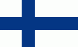
| Flag of Finland | |
Finland was first inhabited around 9000 BC after the Last Glacial Period. The Stone Age introduced several different ceramic styles and cultures. The Bronze Age and Iron Age were characterized by contacts with other cultures in Fennoscandia and the Baltic region. From the late 13th century, Finland became a part of Sweden as a consequence of the Northern Crusades. In 1809, as a result of the Finnish War, Finland became part of the Russian Empire as the autonomous Grand Duchy of Finland, during which Finnish art flourished and the idea of independence began to take hold. In 1906, Finland became the first European state to grant universal suffrage, and the first in the world to give all adult citizens the right to run for public office. After the 1917 Russian Revolution, Finland declared independence from Russia. In 1918, the fledgling state was divided by the Finnish Civil War. During World War II, Finland fought the Soviet Union in the Winter War and the Continuation War, and Nazi Germany in the Lapland War. It subsequently lost parts of its territory, but maintained its independence.
Currency / Language
| ISO | Currency | Symbol | Significant figures |
|---|---|---|---|
| EUR | Euro | € | 2 |
| ISO | Language |
|---|---|
| FI | Finnish language |
| SV | Swedish language |


